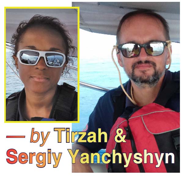
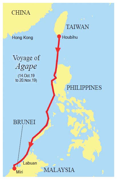
Sergiy and Tirzah Yanchyshyn, the Ukrainian -Montserratian Team from from Maritime Academy Ltd. formerly head of Montserrat Yachting Association, sailed from Taiwan to Borneo in an 18 ft boat.
Here is their story published in a Hong Kong Yachting magazine.
We sailed our FarEast 18 sailboat from Sai Kung at the end of May 2016, intending to berth for a month or two in Kaohsiung Port. We arrived four days later, on a Hapag- Lloyd Panamax which answered our distress call.
Our emergency was simple: our electric engine was dead and we saw weather conditions getting worse in the Taiwan Strait. A typhoon had formed east of Taiwan since our departure from Hong Kong. Though we had passed the Penghu Islands and could see the coast of Tainan, we were getting no closer to land after hours of fighting the growing wind and waves.
While the container ship took us aboard to deliver us safely to Kaohsiung Port, it was the Taiwan Coast Guard who miraculously found our little yacht the next morning drifting near the coast of Jiangjyun fishing harbour (Tainan). It was returned to us on our second day in Taiwan, immediately after activating our visas. It had sustained little damage after a night adrift.
We then spent the next three years analysing our first voyage on a 6-meter sailing yacht. We had sailed without an autopilot, only a 1kW electric engine and minimal equipment. Would we ever dare to push this yacht so far again? If yes, what could we do to be more prepared? After a long list of repairs, upgrades and test sails (to Penghu and other Tainan harbours), we found ourselves needing to reconsider another open sea voyage. By that time, our small yacht was equipped with two chart plotters, a depth sounder, AIS, two personal mobile MOB AIS, an autopilot, Navtex and Yamaha 15hp two-stroke outboard engine.
The decision to sail to East Malaysia was really ‘Plan Z’, though. We needed to move from Taiwan and considered sailing to several destinations nearby, including back to Hong Kong or to the Yaeyama Islands (Okinawa). We even considered shipping our yacht to Malaysia by flat rack on a container ship. Anything sounded better than sailing all those nautical miles on a coastal-range yacht. In the end, each plan was dismissed due to weather, to cost or to practicality—until our resident visas had run out, forcing us to come up with a crazier voyage than the first!
Houbihu to northern Luzon
(13-15 September 2019) Estimated distance: 240 nautical miles
We sailed / motored our FarEast 18 from Jiangjyun fishing harbour to Houbihu Marina (Kenting, Taiwan) in May 2019. Final destination still not decided, yet a berth on the southern tip of Taiwan was a good departure point for multiple directions. It was a relief to be out of the Taiwan Strait.
Our Taiwan Alien Resident Cards expired at the end of September 2019, so we were stocked and ready to sail by the first week of that month. We only prayed for good weather to cross to the Philippines. Since May there had been constant storms / typhoons preventing us from going east to the Yaeyama Islands or west to Hong Kong. Sailing south didn’t look inviting either!
Then, our prayers were answered when we saw a ‘dead zone’ of calm weather between the south of Taiwan and the north of Luzon created by surrounding storms in the region. There was a weather vacuum that would last two to three days, which was the minimum time we needed to make our first open sea passage southward. It was also the exact dates of the Mid-Autumn Festival and the full moon gave us clear visibility at night throughout the crossing.
Agape departed Houbihu Marina at approximately 1400 on the 13th of September 2019. Weather conditions were fair with surprisingly large swells (up to 5 meters) while departing the protection of Kenting Bay. We were grateful that the direction and comfortably long length of these swells pushed us gently in the right direction. These conditions lasted no more than two hours before it was flat seas again with light winds that required us to use our 15hp outboard engine. We had managed to fit six 24-litre gasoline tanks into two of our cockpit lockers: enough fuel to get us to Luzon only on motor (at economical speed) before the Luzon Strait had a chance to swallow us up.
The first night was luminescent with the sea as smooth as glass. We were in awe. It wouldn’t last though. In the middle of the strait the following day, we met choppy conditions despite winds remaining light. The swells were nothing compared to when we departed Kenting Bay but the hours of feeling every 2m wave began to get discouraging. Thankfully this was only a temporary disturbance. After approximately four hours of feeling like tossed salad, the waters became calmer and flatter.
The second night of sailing was less calm than the first, but we were still able to rest. At approximately 1600 on the 15th of September 2019 we rejoiced at the hazy sight of windmills on the northern coast of Luzon. Gently refusing a fisherman trying to sell us fish from his banca, we were able to anchor in a barely protected shallow bay — Isla Furikawa in Pasuquin Municipality — just before sunset. Overnight we hand-washed then air-dried dirty laundry while recalculating our supplies against weather forecasts and distances to the nearest ports where we could refuel. We had used almost all our fuel motoring through unusually calm weather. Consumption was huge, yet insignificant compared to being alive! We decided on the closed port of Salomague for refuelling the next day, as it was the only feasible option. The night grew dark as we shared snacks with local village children who shouted, “The Lord bless you!” as their parents called them to swim back to shore.
Isla Furikawa to Salomague, Poro Point & Subic Bay
(16-25 September 2019) Estimated distance: 325 nautical miles
As the sun rose, we had already lifted anchor and were departing Isla Furikawa. The weather was calm; the sight of land alongside us still comforting after the crossing. By late afternoon on the 16th of September, we were anchored inside Salomague Port where we refilled all six of our 24-litre tanks and bought more supplies. By midday on the 17th of September, we left Salomague in a hurry to get as far south as possible because rougher weather was approaching. We were caught in increasingly stormy conditions on the 18th of September which forced us — and a flock of birds which had been using our sails for protection — to shelter at a small port named Poro Point in San Fernando. Here we did immigration and customs while staying at anchor for five days waiting for clear weather.
With a top up of gasoline as well as a port clearance and quarantine in hand, we left Poro Point at sunrise on the 23rd of September in yet another race to the south before we were caught in more unpredictable weather. The forecast showed that there was a ‘tunnel’ of lighter conditions near to the coast though offshore it was quite rough. Our approach was to plot the positions of all possible safe harbours on the way while trying to sail southward with as little stops as possible.
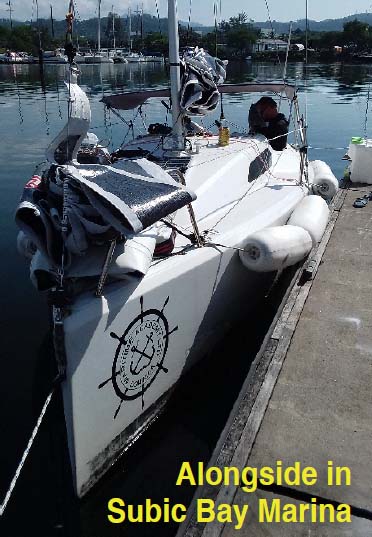
Crossing San Fernando Bay on the 23rd of September was smooth; the greatest danger being the floating seaweed and garbage that sometimes wrapped around our outboard’s propeller. We sailed on light winds that neither helped (nor harmed) our progress on engine. Our average speed was around 4 knots which got us into Subic Bay Yacht Club by sunset on the 24th of September. We had originally planned to do our refuelling at Punto Fuego and bypass Subic Bay altogether. However, our 210Ah battery (12V) had been drained after the constant use of AIS chartplotter and autopilot since departing Taiwan. Also, our battery could only be charged by solar panel but the 5 rainy days of rest at Poro Point hadn’t yielded enough sunlight for a full recharge! We navigated into Subic Bay without AIS on the fringes of a thunderstorm, using an offline chartplotter (Maps. me) on our Samsung tablet to verify our direction. It’s a good thing we stepped onto the Subic Bay Yacht Club floating pontoons just as the sun set. Our solar navigation lights were dying on us, too.
The two nights spent at Subic Bay Yacht Club were a welcome relief. We ate like kings, refuelled, re-stocked, hand-washed laundry and bought a new battery fully charged while leaving our 210Ah battery to recharge by shore power and then by solar power. The solar charging was surprisingly much more effective as the 25th and 26th of September were blazing hot days! Just after midday on the 26th, we left Subic Bay hoping to sail safely from Luzon to Palawan without stopping.
Subic Bay to El Nido
(26-30 September 2019) Estimated distance: 300 nautical miles
Agape mostly motored, with the help of sails when possible, from Subic Bay past Manila Bay under clear, starry skies while dodging ships, fishing boats and numerous illuminated mooring buoys. Towards land, however, there was a gigantic storm cloud over Manila Bay. We tried to pretend it wasn’t there. Neither of us felt like talking about it. We just kept checking wind direction to make sure it was staying where it was. We both silently looked above, thanking God for continued clear skies directly over us. Ahead were many obstacles we had to overcome. By sunrise, the thunderstorm we refused to acknowledge was nowhere in sight and we were in open sea.
The following two days and nights passed with fewer ships to dodge and relatively flat seas. The wind played with us, and so we ‘played’ with the mainsail and jib, making constant adjustments to maximise speed. By the time we were approaching Palawan, however, conditions offshore were rapidly changing contrary to what forecasts had predicted. We grudgingly headed closer to the coast of Palawan on the 29th of September, wanting to be close to safe harbours should another storm hit us. Conditions were volatile as the day progressed until we lowered all sails and put up our storm jib. It would be a very bumpy ride navigating around coral reefs and unmarked mooring buoys for the next 8 hours or so.
Agape entered the barely protected northern harbour of Barangay Bucana in the wee hours of the 30th of September. Exhausted, we dropped anchor at the first suitable depth in the middle of the harbour — we couldn’t see the coastline clearly and didn’t want to risk going closer to land at night, perhaps finding a better anchoring position in the morning.
Next morning, we realised our anchorage was in paradise!
Palawan west coast & Balabac
(30 September – 14 October 2019) Estimated distance: 332 nautical miles
We refuelled in Barangay Bucana and exited the harbour at sunrise on the 3rd of October. By evening shelter was needed because of a thunderstorm. This would become a daily habit for the rest of the journey. Palawan marked the end of night sailing.
The South China Sea is a most capricious woman. She can seem so welcoming and warm, only to betray you in an instant. We were relieved to be exiting the typhoon belt, only to discover freak thunderstorms along the coast of Palawan every single day. Weather forecasts became ‘flimsy’ as local conditions were entirely unpredictable. From video blogs we had researched before setting sail, more seasoned yachtsmen seemed to agree.
We would duck in and out of sheltered harbours like field mice, and would avoid storms at all costs, waiting until the sky cleared. This proved effective, though it had disadvantages. Besides prolonging the voyage, it required us to stay close to shore and, with Palawan’s rugged mountains, most of the steady winds that should have been in our favour were blocked. This meant hundreds of miles spent motoring because of light, shifting winds which often blew from different directions.
We spent a fortune on gasoline because venturing far from shore for the sake of filling our sails also meant throwing caution to the wind! So, do we want to survive or prove that we are real sailors? Acknowledging the miracle of surviving unharmed that far, we thought it foolish to sink ourselves offshore for the sake of being purists. We had not embarked on this journey to be heroes; we were simply delivering our little yacht to fairer waters.
Trying to cover at least 30nm between waypoints, we gave up on night sailing after entering Palawan for several reasons. There were too many unmarked obstacles, floating plastic bags, nylon fishing lines / nets and coral reefs. Additionally, our extended navigation on a yacht extremely ill-suited for cruising meant we were seriously fatigued. We needed to pace ourselves. It had been a frenzy to pass Luzon and leave the regions commonly hit by typhoons. Now progress was restricted because of thunderstorms. It would be a test of our endurance.
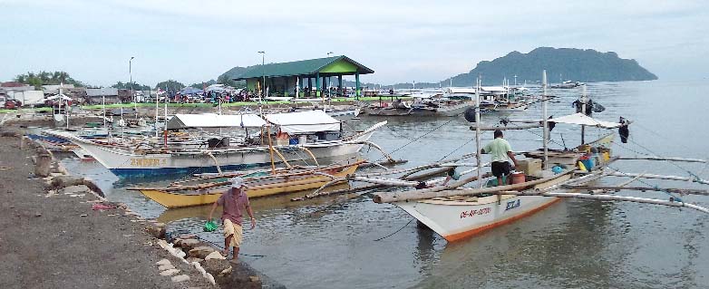
On the 5th of October our gasoline from Subic Bay finally ran out and we switched to using the three tanks filled at Barangay Bucana. To our horror, the fisherman who supplied much of the village fishermen with gasoline had sold us gasoline mixed with water! Our Yamaha began to sputter immediately, no matter which tank we connected. Thank God we discovered the danger at the entrance Ulugan Bay (opposite Puerto Princesa). We immediately steered into the bay at low speed, looking for a good landing to buy fuel and, unwittingly, dropped anchor in a military harbour. Navy officers quickly arrived and we were so happy to see them, although they weren’t happy to see us. They told us we had to exit the harbour immediately and find another anchorage. But, we had already dumped our tainted gasoline so we couldn’t leave until we had more. The officers were sympathetic and helpful, especially after seeing our port clearance and quarantine from San Fernando.
What seemed to be a crisis turned into us being escorted on land by armed naval officers who oversaw us getting all the stock we needed without being overcharged or deceived — quite something in the Philippines. We thanked the officers for their kindness by treating everyone to steaming, mouthwatering bowls of lomi (traditional noodle dish). A banca used for tourists at a nearby resort transported us with our gasoline tanks back to Agape. We then had to leave immediately, at night, to find another anchorage in Ulugan Bay. They suggested Isla Rita which was a small island just outside the military harbour.
We anchored in surprisingly deep water (10m) just a stone’s throw from a sandy shore. In the morning, the beauty of the place took our breath away. It gave us the feeling that, though the journey had been difficult, we were getting to see hidden treasures little known to the world. We said goodbye to Isla Rita on the morning of the 6th of October.
Our last Palawan anchorage was Quezon Alfonso. A beautiful but shallow harbour with surrounding coral reefs for miles and a very confusing entrance. We spent five hours on the 7th of October trying not to ground while entering Malanut Bay. Even Agape’s modest depth of 1.2m seemed too deep. As the sun set, we were able to anchor in 3m with the town’s fishing harbour about 1nm away. In Quezon, it was refuelling, re-stocking and recharging the battery bought in Subic Bay. We left hesitantly, though, knowing that there were no real ‘hiding places’ between Quezon and northern Borneo. But, if we delayed our departure, the weather would not become friendlier either.
On the 13th of October, we crossed the 125nm from Quezon to Balabac without incident. Well, except for a Somalia-registered ship (with a fake MMSI number) appearing on our AIS that looked very much like a pirate ship anchored less than 5nm from us on our way to Balabac island. It was in times like this that we were happy Agape looks more like a dinghy than a luxury yacht. There was also a Philippine Navy ship nearby which soothed our fears a little. Still, with a truck of rough-looking men staring at us on Balabac along with militant Islam in the southern islands, it was best we did not stay longer than necessary. The weather and the need to top up our fuel prohibited us from going into Malaysian coastal waters until sunrise on the 14th of October.
Balaback to Sabah coastal waters
(14 October 2019) Estimated distance: 74nm
Considering the open sea passages we had already completed, sailing to Sabah from Balabac was a skip and a hop! The sea was as smooth as glass while behind us, a thunderstorm was passing over our anchorage at Balabac. It had been the right time to go. A group of curious dolphins approached our yacht, drawn by the sound of the engine.
Though excited to see them play, we shut down our engine quickly to discourage their approach. We had come dangerously close to a group during the storm that led us to Poro Point (San Fernando) and didn’t want them to be damaged by our keel. Without the noise, the scout dolphin and his companion quickly lost interest and swam away.
There was little traffic during our passage to Sabah. The only concern was a massive storm that had formed over Sabah as we approached in the evening of the 14th of October. The wind was growing stronger and seemed to be blowing the heavy clouds east, keeping the west coast of Borneo clear for us. This didn’t last, however. As night fell and we passed Kudat, the wind speed and direction changed drastically. After narrowly avoiding thunderstorms along the coast of Palawan and Balabac, we finally found ourselves in the middle of one of the biggest we had seen.
Our established escape route wouldn’t work this time either. The lightening was striking over the only bay we could use as a safe harbour. We were stuck. Agape would not survive in such weather offshore, and we couldn’t go closer to the coast. We prayed for wisdom. The answer came after spotting on the chart plotter a large coral reef that shot up in the middle of the open sea. It’s shallowest depth was 20m; our ideal depth for anchorage is 5m. Still, we had enough line to get a shaky hold that would hopefully keep us until the storm had passed.
Motoring slowly over the coral reef until we were over its shallowest depth, we dropped anchor from the bow and dragged it to get a firmer hold. Needless to say, this was far from comfortable but at least we could now wait out the storm without trying to navigate in little to no visibility. For the next five or so hours we danced around the anchor line, constantly checking our drift. Our desperate anchorage held surprisingly well. It amazed us that throughout the entire voyage, which included many anchorages in coral reefs, we had not lost either of our two anchors. By sunrise on the 15th of October, the skies were clear and we soon had Mount Kinabalu in sight.
Sabah, Labuan, Brunei, Sarawak
(15 October – 20 November 2019) Estimated distance: 315nm
The passage along the coast of Borneo from Sabah to Sarawak went very similarly to Palawan. No night sailing; constant thunderstorms. We anchored at Kota Belud, Kota Kinabalu, Kuala Penyu, Labuan and Kampong Sungai Liang (Brunei) before entering Miri Marina on the 20th of November. Our arrival in Miri City was delayed when we arrived at Labuan Marina on the 18th of October and saw no suitable weather for a quick departure. A little disheartened that we were so close yet so far, Agape was berthed in Labuan while we traveled out of Malaysia — we were happy for the much needed break from living aboard a cramped 18-foot yacht.
We left Labuan Marina on the 19th of November, overnighting on the coast of Brunei, and arrived at our final destination at 1500 on the 20th of November 2019.
Was it all worth it? Of course. Would we do it again? Not on an 18-footer. What was the biggest lesson learnt? Anything is possible for he who believes!
NAUTICAL MILEAGE BREAKDOWN (Houbihu Marina to Miri Marina)
- Houbihu (Kenting, Taiwan) to Isla Furikawa ………………………… 240 nm
- Isla Furikawa to Salomague ……………………………………………….. 50 nm
- Salamague to Poro Point, San Fernando ……………………………. 100 nm
- Poro Point, San Fernando to Subic Bay Marina …………………… 175 nm
- Subic Bay Marina to Bucana …………………………………………….. 300 nm
- Bucana to Ulugan Bay Navy Base ……………………………………… 107 nm
- Ulugan Bay to Quezon Alfonso ………………………………………….. 100 nm
- Quezon Alfonso to Balabac ………………………………………………. 125 nm
- Balabac to first stop in Sabah (coral reef) ……………………………… 74 nm
- Sabah (coral reef) to Kota Belud (Sabah) ……………………………… 55 nm
- Kota Belud to Kota Kinabalu ……………………………………………….. 40 nm
- Kota Kinabalu to Kuala Penyu …………………………………………….. 40 nm
- Kuala Penyu to Labuan ………………………………………………………. 45 nm
- Labuan to Kampong Sungai Liang (Brunei) …………………………… 75 nm
- Kampong Sungai Liang (Brunei) to Miri (Sarawak, Malaysia) ….. 60 nm
Total estimated distance covered : 1,586 nautical miles
